

Land Survey Cost on Desert Acreage: Why Two Similar Parcels Can Produce Different Quotes
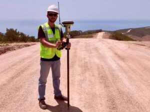
Two neighbors ask for survey quotes on parcels that look almost identical. Same acreage. Same general area. But the quotes come back thousands of dollars apart.
This happens more than people expect. Land survey cost depends on far more than the number of acres on a deed.
Understanding what actually drives the price helps you ask better questions and avoid surprises when the invoice arrives.
Similar Acreage Does Not Mean Similar Boundary Evidence
Acreage tells you how big a parcel is. It does not tell you how easy or hard it will be to confirm where that parcel actually sits.
A surveyor has to find or reconstruct the boundary using deeds, old survey records, and physical markers in the ground. One parcel might have clear monuments still in place. Another might have markers that were buried, removed, or never set correctly to begin with.
Desert land often sits on parcels that were divided decades ago. Some have solid records. Others do not.
Things that affect how much boundary evidence a surveyor has to work with include:
- Whether original survey monuments still exist on site
- How complete and accurate the recorded deed is
- Whether nearby parcels have been resurveyed recently
- Whether prior surveys used the same reference points
Weak or missing evidence means more time spent researching and reconstructing the boundary. That time shows up in the final land survey cost.
Parcel Shape Can Change the Amount of Fieldwork
A square or rectangular parcel is usually simple to survey. Fewer corners mean fewer points to locate and less time in the field.
An irregular parcel is a different story. More corners, angled lines, or narrow sections all add fieldwork. Each corner needs its own measurement, and each measurement takes time.
Desert parcels sometimes have unusual shapes left over from older land divisions or mining claims in the surrounding area. A five-acre rectangle and a five-acre L-shaped parcel are not the same job, even though the acreage matches on paper.
Why Shape Matters More Than Size
A larger, simple parcel can sometimes cost less to survey than a smaller, oddly shaped one. Ask your surveyor how the parcel’s shape factors into their estimate, not just the total acreage.
Desert Access Conditions Can Change Survey Crew Time
Getting a survey crew and equipment onto a parcel takes longer in some desert conditions than others. This directly affects how much time a job takes, which affects the final cost.
Rough terrain, loose sand, washes, and steep grades all slow down fieldwork. A parcel with an easy dirt road in is a very different job than one that requires hiking equipment across uneven ground.
Conditions that commonly affect access time in the area include:
- Distance from a maintained road
- Terrain steepness or loose soil
- Seasonal washes that affect vehicle access
- Vegetation or debris that blocks sightlines between points
A remote desert parcel with difficult access can take a full crew significantly longer to survey than a similar parcel with easy road access, even if both properties are the same size.
Older Records Can Require More Boundary Research
Some parcels come with clean, well documented records. Others come with decades of gaps, conflicting descriptions, or handwritten notes that do not match modern mapping standards.
Older desert parcels, especially those tied to historic mining claims or early land patents in the region, sometimes fall into this second category. A surveyor may need to dig through county records, old plats, and prior survey files before any fieldwork even begins.
This research phase does not show up on the ground, but it takes real time. Signs that a parcel may need extra research include:
- A legal description that references old or unclear landmarks
- No record of a prior survey on file
- Conflicting acreage figures between different documents
- A chain of title with multiple splits or transfers over the years
If your parcel has any of these characteristics, ask your surveyor early how much research time they expect to need. This helps set realistic expectations for both cost and timeline.
Survey Scope Can Make Similar Properties Produce Different Quotes
Not every survey request covers the same scope of work. A basic boundary survey and a full ALTA survey are very different jobs, even on the same size parcel.
Scope differences that affect land survey cost include:
- Whether the survey only marks corners or also maps topography
- Whether the survey needs to meet ALTA standards for a commercial transaction
- Whether easements and improvements need to be located and shown
- Whether the survey supports a sale, a loan, a permit, or a boundary dispute
Two owners requesting quotes on similar parcels may actually be asking for different levels of detail without realizing it. Confirm exactly what your project needs before comparing quotes, since a lower price sometimes reflects a smaller scope rather than a better deal.
Requirements can vary by lender, title company, or county, so if your survey supports a closing, permit, or construction timeline, confirm your scope needs as early as possible.
Frequently Asked Questions
Why do land survey quotes vary so much for similar parcels?
Cost depends on more than acreage. Boundary evidence, parcel shape, access conditions, record quality, and survey scope all affect how much time and work a job requires.
Does desert terrain really affect land survey cost?
Yes. Rough access, loose soil, and remote locations can slow down fieldwork significantly, which adds time and cost compared to a similar parcel with easier access.
How can I get an accurate land survey cost estimate?
Give the surveyor as much information as possible about the parcel, including any prior survey documents, known access conditions, and the exact purpose of the survey.